


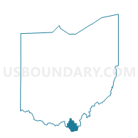
COAL GROVE C Voting District, Lawrence County, Ohio
About
Outline

Summary
| Unique Area Identifier | 648510 |
| Name | COAL GROVE C Voting District |
| County | Lawrence County |
| State | Ohio |
| Area (square miles) | 0.78 |
| Land Area (square miles) | 0.71 |
| Water Area (square miles) | 0.07 |
| % of Land Area | 90.99 |
| % of Water Area | 9.01 |
| Latitude of the Internal Point | 38.50457570 |
| Longtitude of the Internal Point | -82.64504600 |
Maps


Graphs
Select a template below for downloading or customizing gragh for COAL GROVE C Voting District, Lawrence County, Ohio


Neighbors
Neighoring Voting District (by Name) Neighboring Voting District on the Map
- COAL GROVE A Voting District, Lawrence County, OH
- COAL GROVE B Voting District, Lawrence County, OH
- IRONTON 4G Voting District, Lawrence County, OH
- IRONTON 4I Voting District, Lawrence County, OH
- PERRY 1 Voting District, Lawrence County, OH
- UPPER 3 Voting District, Lawrence County, OH